Thru-Hikes of Europe: 17 Great Long-Distance Trails
🗺 View the 14 places in this post on a map
Europe does long-distance walking differently. Instead of weeks of self-sufficiency, most routes here link villages, mountain huts, and pilgrim hostels, so you carry a light pack and end each day with a hot dinner and, often, a glass of wine. That makes the continent the best place in the world to try a first multi-week walk — and it also hides some of the hardest trails anywhere, from Corsica's GR20 to Sardinia's rope-assisted Selvaggio Blu.
Here are all 17 European routes from our Thru-Hikes of the World overview, grouped by style, with maps. Distances are approximate; difficulty assumes a fit hiker with a multi-day pack.
- 1Camino Francés
- 2Tour du Mont Blanc
- 3GR20
- 4Walker's Haute Route
- 5West Highland Way
- 6Pennine Way
- 7South West Coast Path
- 8Laugavegur Trail
- 9Kungsleden
- 10Alta Via 1
- 11Alta Via 2
- 12Grande Traversata delle Alpi
- 13Via Francigena (Italy)
- 14Selvaggio Blu
- 15GR11 (Senda Pirenaica)
- 16Lycian Way
The pilgrim routes. The Camino Francés (St-Jean-Pied-de-Port to Santiago de Compostela, ~500 miles, 4–6 weeks, moderate) is the most walked long-distance route in the world: over the Pyrenees, through Rioja's vineyards, across the flat meseta, and into green Galicia, with albergues every few miles. In León, skip the cathedral-square restaurants for the Barrio Húmedo, where a drink comes with a free tapa at every bar. Variants — the coastal Norte, the Portugués from Porto, and the mountainous Primitivo (see our Camino Primitivo guide) — are quieter. Italy's answer is the Via Francigena (Great St Bernard Pass to Rome, ~620 miles, 6–7 weeks, moderate): the 990 AD pilgrim road down through the Po rice paddies, the towers of Lucca and San Gimignano, and the cypress hills of Tuscany to St Peter's, with a testimonium waiting in Rome.
- 1Camino Francés
- 2Via Francigena (Italy)
- 3GR11 (Senda Pirenaica)
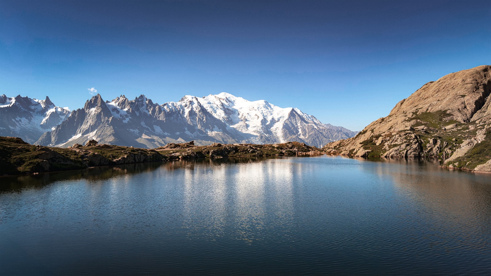
The Alps. The Tour du Mont Blanc (~105-mile loop through France, Italy, and Switzerland, 7–11 days, challenging) is Europe's most popular alpine circuit — ten passes, about 33,000 feet of climbing, and refuges serving hot dinners; book huts far ahead for late June through mid-September. Rifugio Bonatti, above Val Ferret on the Italian side, has the best terrace view of the whole loop. The Walker's Haute Route (Chamonix to Zermatt, ~112 miles, 10–14 days, strenuous) is its harder cousin, crossing eleven passes from Mont Blanc to the Matterhorn without glacier travel. In Piedmont, the Grande Traversata delle Alpi (~620 miles, 8–10 weeks, strenuous) is the anti-TMB: a traverse of the whole Italian side of the western Alps through valleys that emptied in the 20th century, sleeping in posti tappa village inns that see few outsiders.
- 1Tour du Mont Blanc
- 2Walker's Haute Route
- 3Grande Traversata delle Alpi
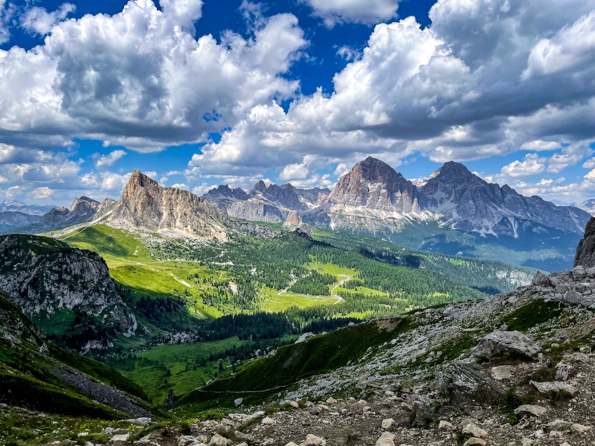
The Dolomites. Alta Via 1 (Lago di Braies to Belluno, ~75 miles, 8–12 days, challenging) is the accessible classic: hut-to-hut beneath the Fanes, Tofane, and Civetta walls with excellent Italian food nightly and WWI history throughout. The cable car up to Rifugio Lagazuoi above Passo Falzarego lets non-hikers join you for a night at 2,752 meters with the best sunset in the range. Alta Via 2 (Bressanone to Feltre, ~100 miles, 12–14 days, strenuous) is the wilder sibling — steeper passes, more exposure, and a few protected sections where a via ferrata kit is recommended.
- 1Alta Via 1
- 2Alta Via 2
Islands and coasts. The GR20 (Calenzana to Conca, Corsica, ~112 miles, 12–16 days, strenuous to expert) is reputedly the toughest waymarked trail in Europe: constant steep scrambling, chains and slabs in the north, and exposed ridge weather. The Selvaggio Blu (Golfo di Orosei, Sardinia, ~31 miles, 4–7 days, expert) is shorter and harder still — unmarked route-finding along limestone cliffs, scrambling, multiple abseils, and water dropped by boat. The GR11 (Spanish Pyrenees, Atlantic to Mediterranean, ~510 miles, 6–7 weeks, strenuous) crosses Ordesa's canyons and the granite lakes of Aigüestortes on the sunnier side of the range. The Lycian Way (Fethiye to Antalya, Turkey, ~475 miles, 4–6 weeks, challenging) follows the Turquoise Coast past Lycian rock tombs, beaches, and the flaming vents of Mount Chimaera, with village pensions for beds; go in April–May or October.
- 1GR20
- 2Selvaggio Blu
Britain. The West Highland Way (Milngavie to Fort William, ~96 miles, 5–8 days, moderate) is the ideal first long walk: Loch Lomond, Rannoch Moor, Glencoe, the Devil's Staircase, and pubs every night. The Clachaig Inn in Glencoe is a short detour from Kingshouse and worth it for the climbers' bar. The Pennine Way (Edale to Kirk Yetholm, ~268 miles, 2.5–3 weeks, challenging) is Britain's first National Trail and its grittiest — peat bog, rain, and mist along the backbone of northern England, with a stop at the Tan Hill Inn, Britain's highest pub at 1,732 feet. The South West Coast Path (~630 miles, 7–8 weeks, challenging) hugs the clifftops of Devon, Cornwall, and the Jurassic Coast; the constant drops to coves add up to roughly 115,000 feet of ascent. See also our most scenic Munros guide.
- 1West Highland Way
- 2Pennine Way
- 3South West Coast Path
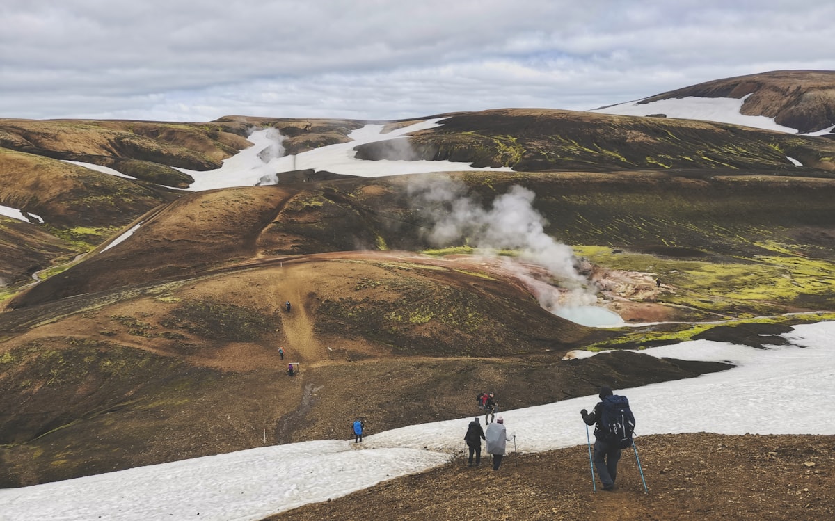
The North. Iceland's Laugavegur Trail (Landmannalaugar to Þórsmörk, ~34 miles, 3–5 days, moderate to challenging) packs rhyolite mountains striped orange and green, steaming geothermal fields, obsidian lava, black-sand desert, and glacial fords into four days; most hikers extend over Fimmvörðuháls to Skógar, between the glaciers Eyjafjallajökull and Mýrdalsjökull. Snow happens in July. Soak in the natural hot river at Landmannalaugar the night before you start. Sweden's Kungsleden (Abisko to Hemavan, ~270 miles, 3–4 weeks, moderate to challenging) crosses Arctic birch forest and open tundra past the Kebnekaise massif, with a hut system — some with saunas — and rowboat lake crossings under the midnight sun; the northern Abisko–Nikkaluokta week is the classic section.
← Back to the overview: Thru-Hikes of the World. Planning your Iceland trip? Start with our Ring Road camper van guide.