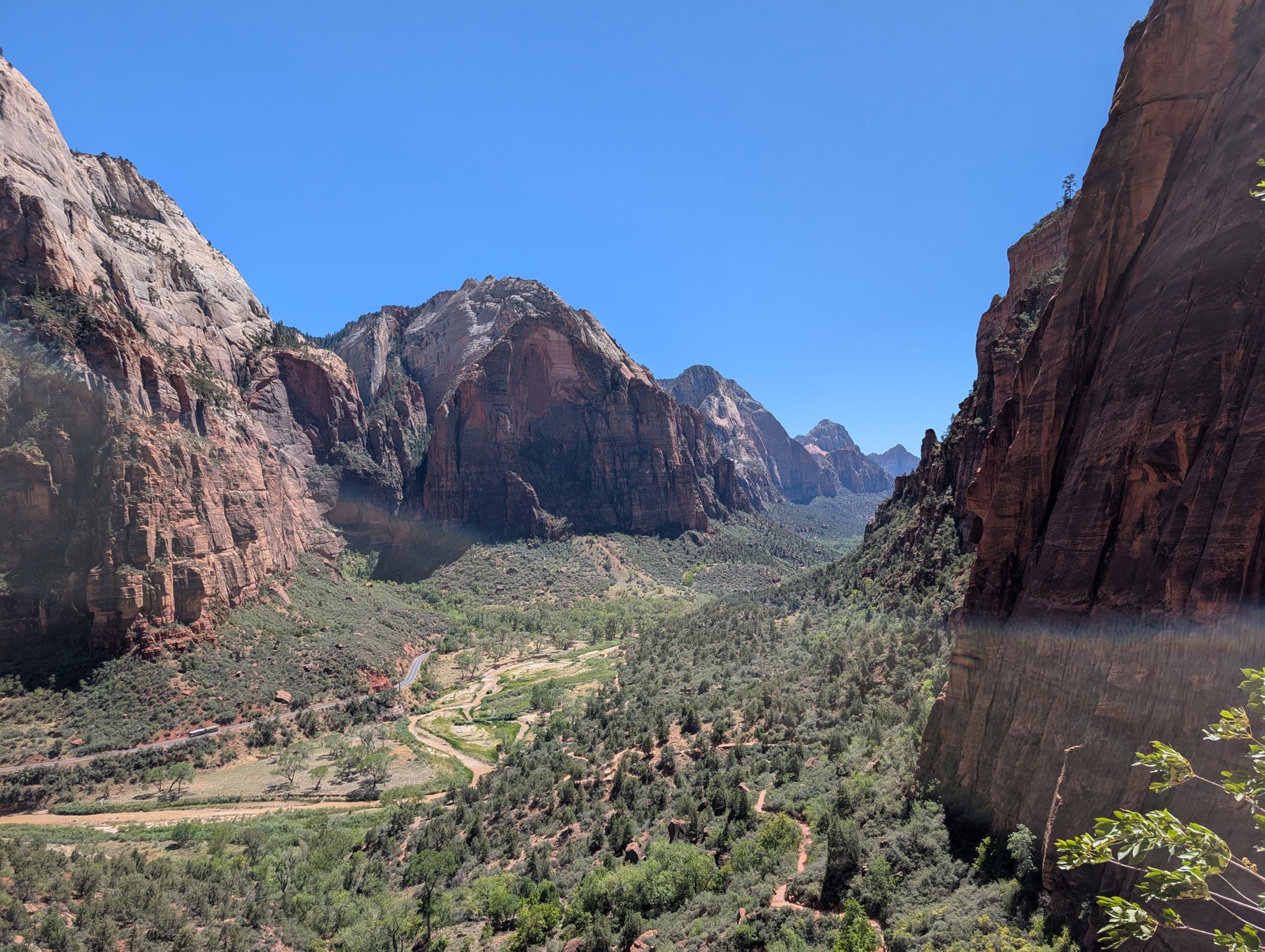
Zion National Park: Angels Landing, the Narrows & Beyond
🗺 View the 14 places in this post on a map
Zion National Park is Utah's busiest national park for a simple reason: nowhere else in the Southwest puts this much vertical sandstone this close to a walkable trail. The Virgin River has cut a canyon half a mile deep, and the two most famous hikes in America run straight through it — one along a knife-edge ridge, one up the river itself. The logistics matter more here than in most parks: Zion Canyon is closed to private cars most of the year, so you'll ride the free Zion Canyon Shuttle from the visitor center, and the marquee hike requires a permit won by lottery. Give Zion two or three full days, and if you can choose your season, come in September or October — summer's 100°F afternoons fade, the cottonwoods turn gold, and the Narrows usually runs low and clear.
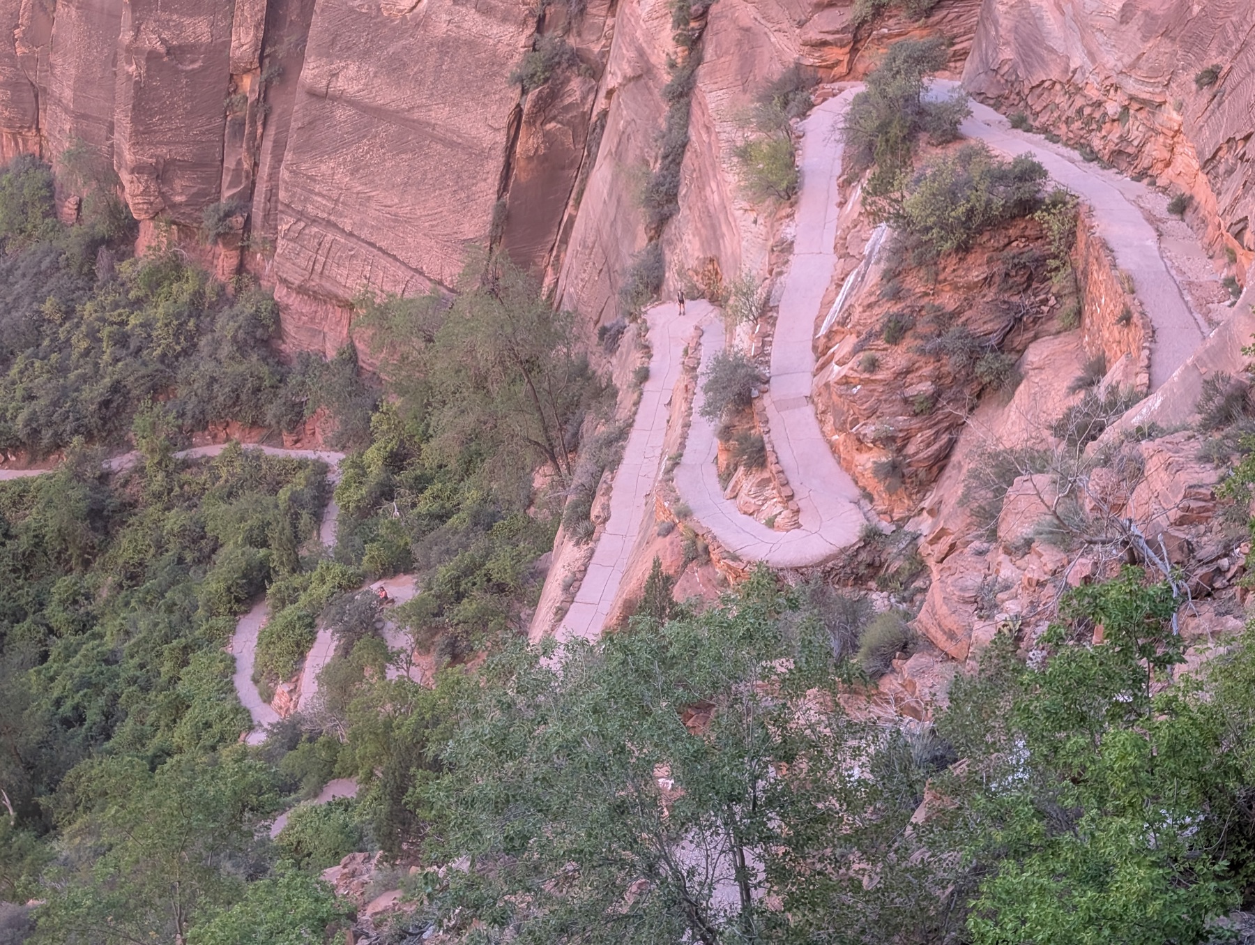
Angels Landing is the hike everyone comes for, and the permit is easier to get than you'd think. Since 2022 the final half mile has required a permit, issued by lottery on recreation.gov: a seasonal lottery months ahead, plus a day-before lottery that runs from 12:01 a.m. to 3 p.m. Mountain Time with results at 4 p.m. Either way it's $6 per application for up to six people, plus $3 per person when you win. The hike itself is about 5.4 miles round trip from the Grotto shuttle stop: paved switchbacks to the cool slot of Refrigerator Canyon, then Walter's Wiggles — 21 stacked stone switchbacks engineered in 1926 — up to Scout Lookout, where the paving ends and the chains begin.
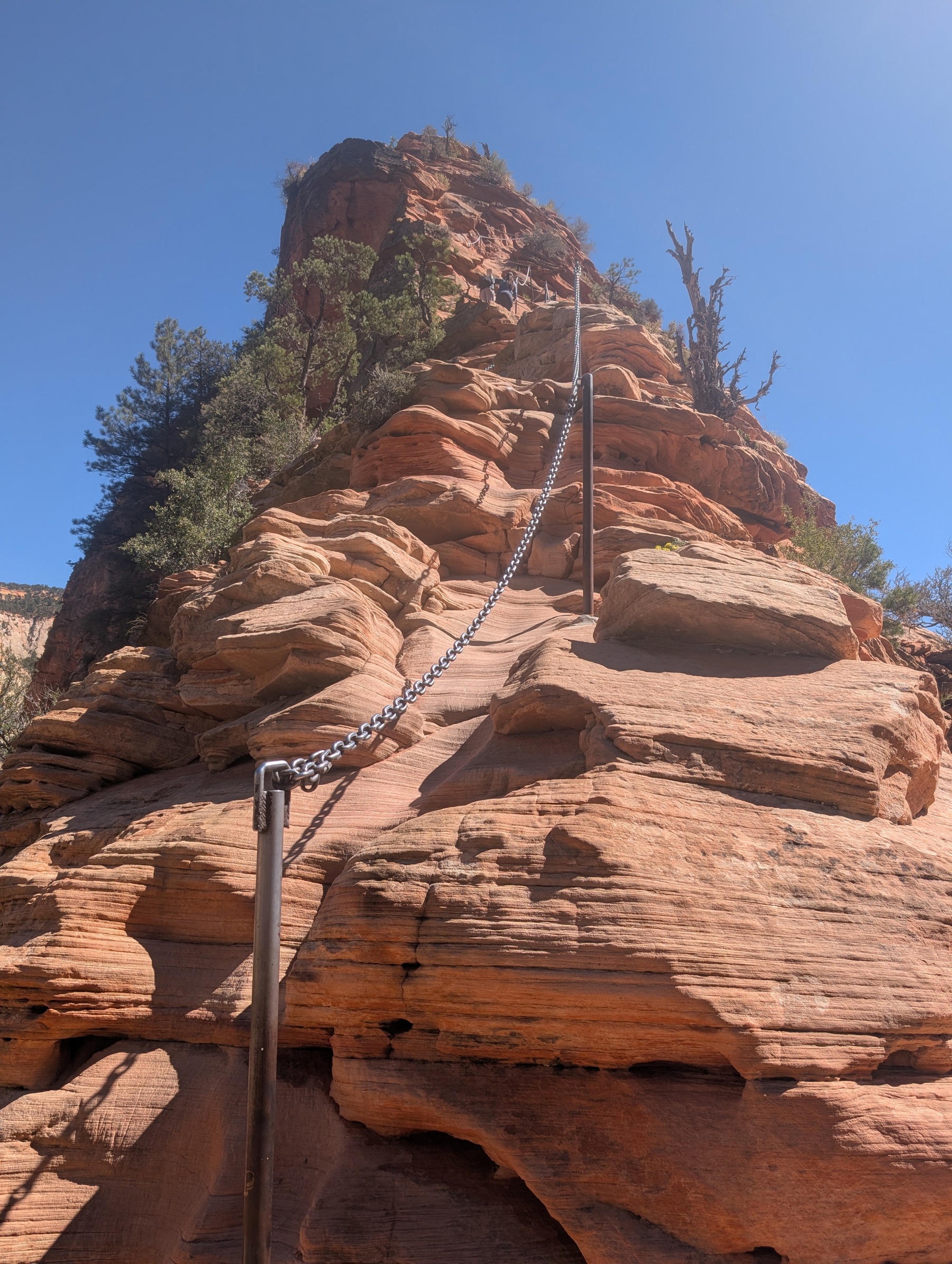
The last half mile is the part you've seen in photos: a scramble along the spine of a sandstone fin, gripping bolted chains, with the canyon floor a thousand feet down on both sides. It's genuinely exposed — take it slow, yield at the wide spots, and skip it outright in rain, ice, or high wind. Here's the thing the permit line doesn't tell you: Scout Lookout requires no permit at all, and its view down canyon is 90 percent of the payoff. If the lottery doesn't go your way, hike to the lookout anyway and continue ten minutes north on the West Rim Trail, where the crowds vanish and the views over Zion Canyon keep getting bigger.
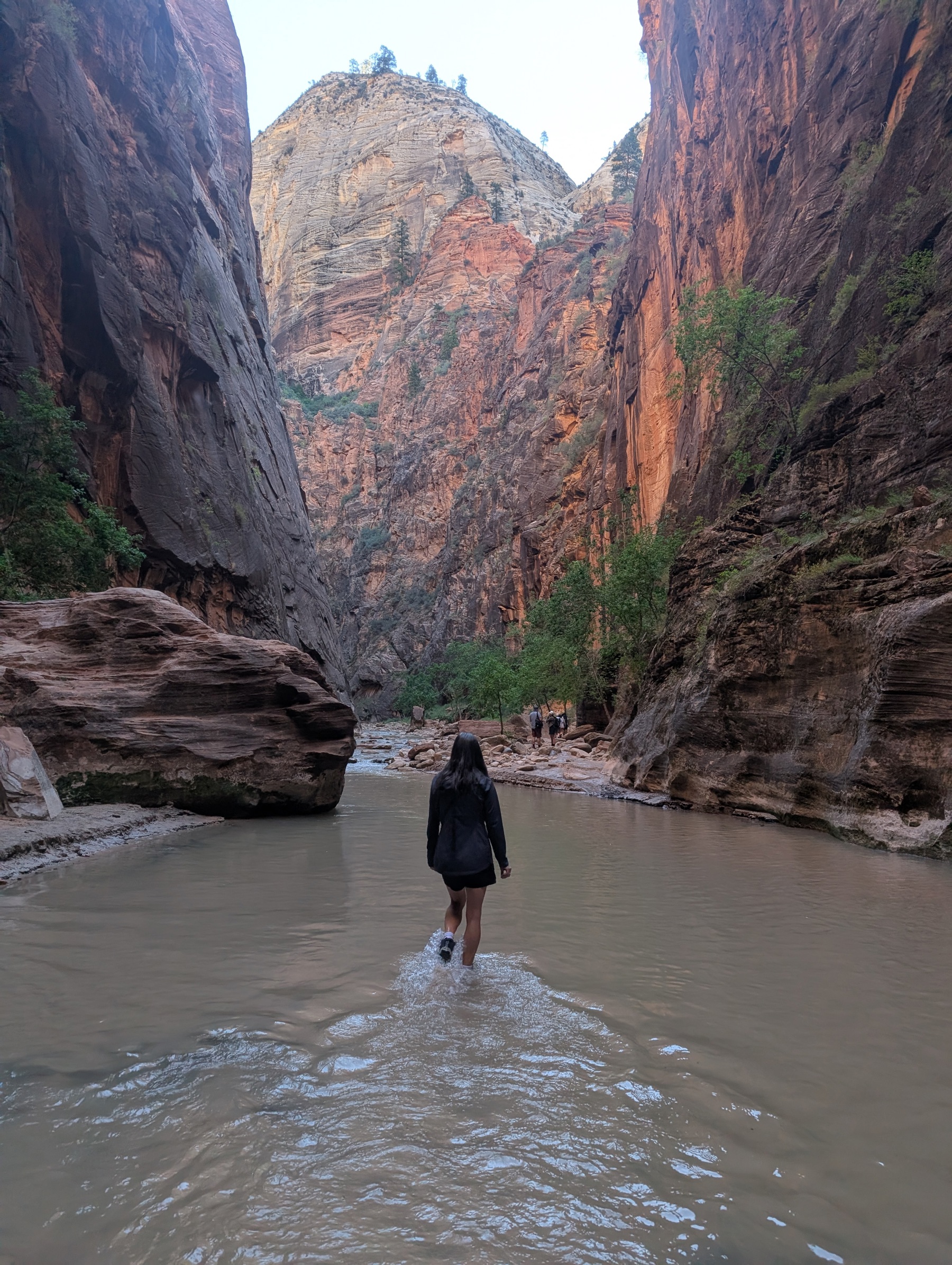
The Narrows is the other bucket-list hike, and it has no trail — the Virgin River is the trail. Ride the shuttle to the last stop, Temple of Sinawava, follow the paved Riverside Walk for a mile, then step in and wade upstream between walls that close to twenty feet apart and rise a thousand. Go as far as you like and turn around; the stretch from Mystery Falls to Wall Street, three to five miles round trip, is the classic bottom-up day. In any season beyond high summer, rent canyoneering boots, neoprene socks, and a wooden staff in Springdale at Zion Outfitter, steps from the park's pedestrian entrance, or Zion Adventure Company — ankle support and traction on greased bowling-ball cobbles are worth every penny. Check conditions before you commit: the park closes the river when flow is high, and flash floods are a real danger — if rangers post a flood warning, this is a hike for another day.
Don't skip the east side. The Zion–Mount Carmel Highway climbs out of the canyon through a 1.1-mile tunnel blasted in 1930 and emerges into a different park: white slickrock domes, cross-bedded waves of stone, and the etched grid of Checkerboard Mesa. Park just east of the tunnel for the Canyon Overlook Trail — one mile round trip, about an hour, ending at a ledge with a full-frame view down Pine Creek Canyon to the towers of the main canyon. It's the best view-per-step ratio in Zion, it needs no shuttle and no permit, and at sunrise you might share it with a handful of photographers instead of a busload.
The quiet alternative locals use: the park's other canyon. Forty-five minutes north on I-15, the Kolob Canyons section has its own entrance, a five-mile scenic road, and a fraction of Zion Canyon's traffic. The Timber Creek Overlook Trail at road's end is an easy mile out to a ridge facing a wall of 2,000-foot finger canyons that glow furnace-red at sunset. Between Kolob and the main park, the town of Kanarraville hides Kanarra Falls — a wade-and-scramble slot canyon with a 20-foot ladder bolted beside a waterfall. It's on town land, so it needs its own $15 permit, capped at 200 people a day; that cap is exactly why the slot still feels wild while the Narrows hosts a conga line.
Springdale, the town at the park gate, rewards anyone who walks past the gift shops. Start the morning at Deep Creek Coffee, the local roaster's patio where guides fuel up before the first shuttle, and come back after your hike for the burritos and green-chile everything at Oscar's Cafe, a decades-old family patio joint under the cliffs. And two in-park walks solve the classic Zion problems: when the morning shuttle line snakes across the plaza, the Watchman Trail starts right at the visitor center — 3.3 miles round trip to a mesa viewpoint over the canyon mouth with a fraction of the foot traffic. And at golden hour, stroll the paved Pa'rus Trail along the river — the only trail in Zion open to bikes and leashed dogs — to watch the Watchman catch the day's last light. Keep an eye on the river: great blue herons stalk the shallows, and the big white trumpets of sacred datura unfurl along the path edges at dusk.
Practical notes: the shuttle runs through Springdale too, so park once at your hotel and forget the car — in-park day parking fills by 8 a.m. most of the season. To sleep inside the park, Zion Lodge is the only option and books out months ahead; otherwise Springdale puts you five minutes from the entrance, and Utah's official travel site has honest shoulder-season advice. Carry more water than feels reasonable — a gallon per person on hot days — and remember the desert rule that applies to both marquee hikes: start early, not just for parking, but because afternoon is when the heat, the crowds, and the thunderstorms all arrive together.