Cliffs of Moher Coastal Walk: The Best Hike I've Ever Done
🗺 View the 13 places in this post on a map
In the summer of 2017 I walked the entire Cliffs of Moher Coastal Walk — roughly 10 miles from the fishing village of Liscannor, up over Hag's Head, past O'Brien's Tower and the visitor center, and down into Doolin. Nine years and a lot of trails later, it is still, without much competition, the best hike of my life. For five hours the Atlantic was on my left, 700 feet straight down, and the path never once left the edge of Europe.
I'm writing this now for two reasons. The first is that I want people to know what that walk was, because most visitors only ever see the paved kilometer beside the visitor center. The second is harder: as of August 2026, most of the trail is closed. The 6-kilometer southern stretch from Liscannor and Hag's Head to the visitor center is shut entirely on safety grounds, and the northern Doolin section is open only for its first few hundred meters. Here's what it was like, what you can still do today, and why I'm hopeful it comes back.
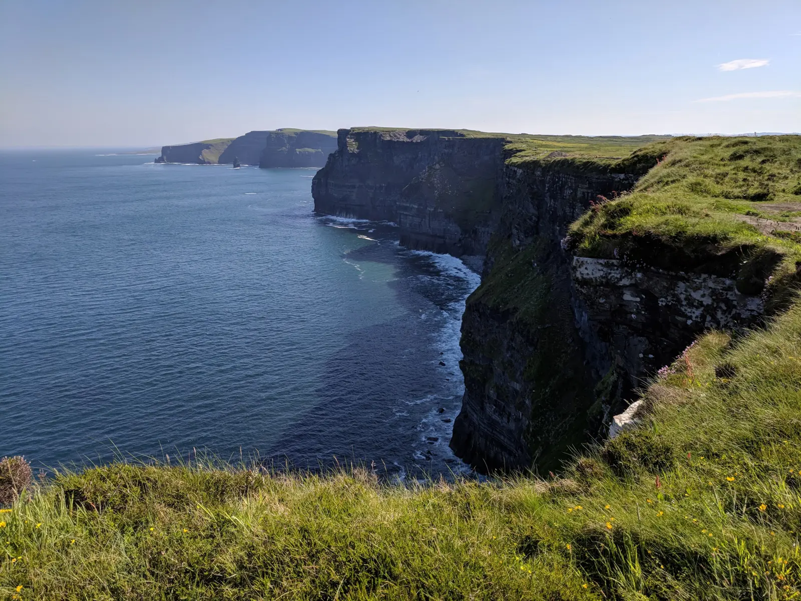
Liscannor to Hag's Head: the quiet beginning. The walk starts unpromisingly, on a lane out of Liscannor past stone walls and grazing cattle, before turning toward the sea and climbing gently across fields. Then the ground simply ends. Hag's Head is the southern tip of the cliffs, crowned by the squat stone stump of Moher Tower, a Napoleonic-era signal tower, and from there the whole 8-kilometer wall of the cliffs unrolls to the north for the first time — layer on layer of black shale and sandstone, the visitor center a tiny notch in the skyline, O'Brien's Tower a speck at the far end. Almost nobody was up there. This southern half was the wildest part of the whole day: a grassy path along the very lip of the cliffs, sea pinks and kidney vetch in the turf, fulmars hanging motionless in the updraft at eye level, and every few hundred meters a new headland pulling the view a little further open. It was also, in hindsight, the part that was too close to the edge — the reason for the closure today.
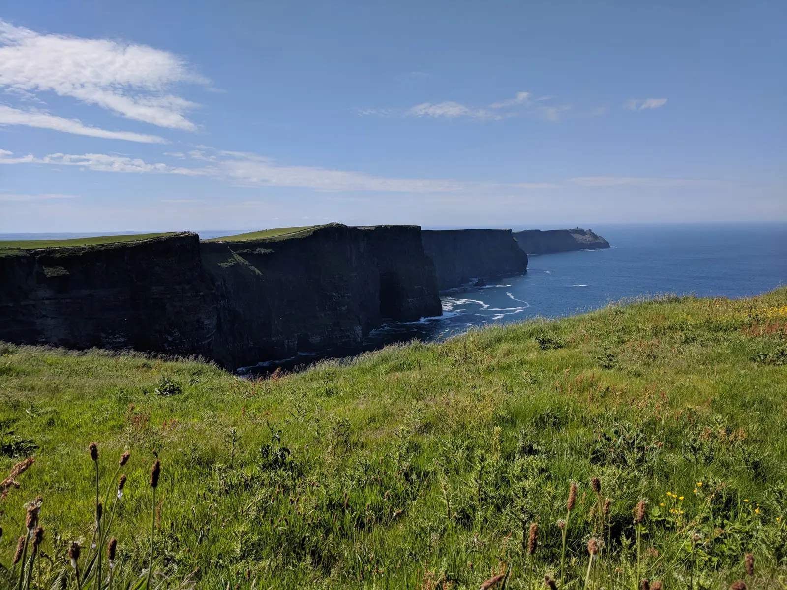
O'Brien's Tower and the crowds. About two hours in, the path meets the visitor-center section — the flagstone-walled promenade most people know, with O'Brien's Tower on its knoll and the sea stack of Branaunmore standing off the cliffs below it. After the emptiness of Hag's Head the buses and selfie sticks were a jolt, but it is also the highest point of the walk, 214 meters above the water, and on a clear day the Aran Islands and the Twelve Bens of Connemara are laid out to the north. I bought a coffee, sat on the wall for twenty minutes, and then did the thing almost nobody does: kept walking.
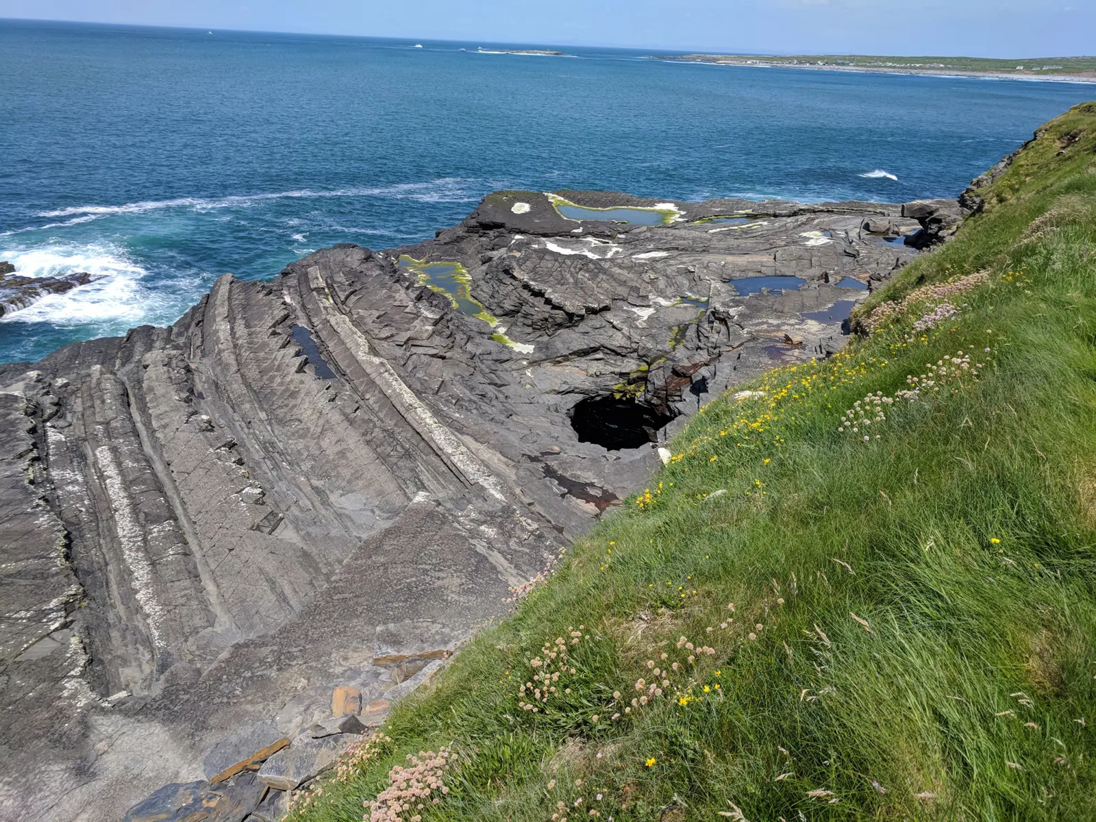
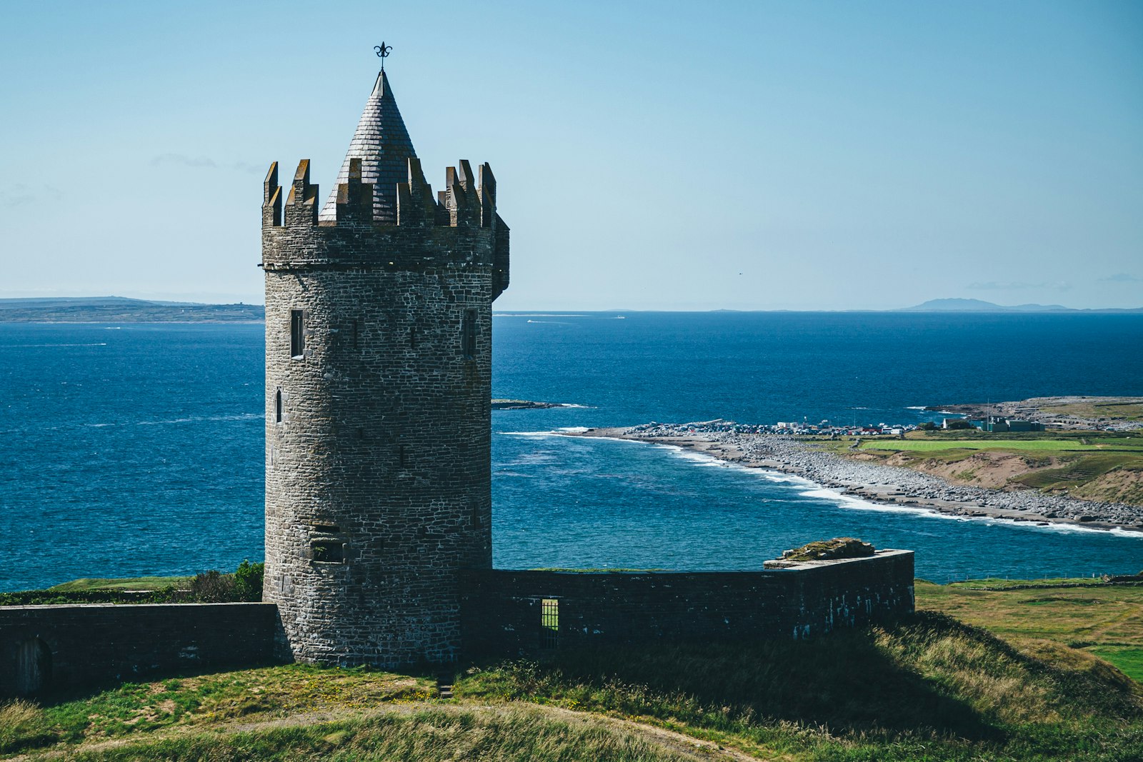
Visitor center to Doolin: the grand finale. North of the tower the crowds thin within five minutes and the cliffs, if anything, get more dramatic — taller, more sheer, with the surf breaking on ledges hundreds of feet down. The path passes above Aill na Searrach, the reef where the giant Aileen's wave breaks in winter and where the surfers you may see are heading, then begins the long descent toward Doolin. The last mile is my favorite stretch of trail anywhere: the cliffs step down into tilted shelves of Liscannor flagstone that dip into the sea like the pages of a book, Doonagore Castle appears on the hill above the village, and the ferries to the Aran Islands come and go from Doolin Pier below. I walked into Doolin sunburned, wind-deaf, and completely happy, and had the pint at Gus O'Connor's that I still think about.
Why it closed. The Cliffs of Moher Coastal Walk is an 18-kilometer, Grade 5 ("very difficult") trail managed by the Clare Local Development Company. In summer 2024 Sport Ireland's biennial inspection flagged sections that ran too close to an eroding cliff edge, and there were fatalities on the cliffs that year. In February 2025 the council and CLDC confirmed the trail would be largely closed for the season: the whole southern section from Hag's Head to the visitor center "definitely" would not reopen in 2025, and the fix is not a repair but a relocation — moving the path back from the edge, which means planning permission and agreements with 38 separate landowners. That takes time. Clare County Council said it was "working diligently," and it has delivered one piece so far: an 800-meter stretch north of O'Brien's Tower was resurfaced and reopened in 2025.
What's actually open in 2026. Check cliffsofmoher.ie before you go, but as of this writing:
At the Cliffs of Moher Visitor Experience you can walk about 3.5 km in total: roughly 1 km north past O'Brien's Tower on the new resurfaced path, and 1.5 km round trip south to the Southern Viewing Platform. That is the best of the elevated views, and it's genuinely worth the ticket. From Doolin, the trail is open from the village as far as Surfers Path (about 500 m) — the sign there tells you to turn around, and you should; there is no through-route to the center. The Liscannor–Hag's Head–visitor center section is closed end to end. The one way to stand on Hag's Head is Guerin's Path, a privately run farm access off the Liscannor road that charges a few euros for parking and a two-minute walk to the viewpoint — it operates independently of the trail closure, so ask locally whether it's open on the day.
Two alternatives fill the gap well. Doolin Pier runs cliff cruises that put you at the foot of the 200-meter wall — a perspective the walk never gave me — and the same pier is the ferry to Inis Oírr and Inis Mór, where the cliff walk to Dún Aonghasa is wide open. And 45 minutes south on the Loop Head peninsula, the Kilkee Cliff Walk is an 8-kilometer loop from the Diamond Rocks Café along sea stacks and blowholes with a fraction of the visitors; it is the closest thing in Clare right now to what Moher used to be.
Base yourself in Doolin or Liscannor. Doolin is the obvious choice: Gus O'Connor's Pub on Fisher Street has trad sessions most nights, and Doolin Cave, ten minutes inland, hides one of the longest free-hanging stalactites in the world. Liscannor is quieter and closer to the southern trailhead; Vaughan's Anchor Inn, a third-generation family pub with a Michelin-Guide-listed seafood restaurant, is reason enough to stop, and Lahinch's beach and surf schools are five minutes further. If you want to walk what's open, do the visitor-center section early in the morning or after 5 pm, when the coach traffic is gone and the light is low across the water — bring a windproof layer whatever the forecast, because on the cliffs there is no such thing as calm.
Hoping for a comeback. I understand the closure. The path I walked in 2017 was in places a boot-width from the drop, and the cliffs are eroding; the people who died were not being reckless. Moving the trail inland is the right call, and if the new route loses a few of the more vertiginous moments it will still be one of the finest coastal walks in Europe. What I hope is that it isn't allowed to quietly fade into a permanent "visitor center loop" — that the landowner agreements get signed, the planning goes through, and one day soon someone else gets to leave Liscannor after breakfast and walk into Doolin at dinnertime with the ocean on their left the whole way. When it reopens, I'll update this post — and I'll be on the first flight.

About the author
Kristian Ranstrom
I built Get Busy Exploring because I kept losing track of where I'd been. I chase lists — fourteeners, highpoints, Munros — and I'm just as happy getting lost in a city on foot. I write up the trips here: routes, itineraries, and what I'd do differently.